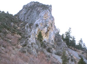
Burnt River Near the tiny town of Durkee (not Dierkes), Oregon, about 2 hours from Boise, is nestled an outstanding band of limestone on the banks of the less than mighty Burnt River. As of the summer of 2000, there were Approximately 40 sport routes on this area's limestone towers. There is the potential for many more routes and the main developers tend to be prolific. Many of these routes are located right along the roadside affording very easy access but the densest concentration of routes is in the ironically named French Gulch. The nature of the climbing is typically steep and powerful but there are also some delicate slab routes to make your brain hum. The climbing season is more or less the same as Boise's. To reach Burnt River from Boise, drive about 94 miles west on I-84, past Ontario, to Durkee (20 some miles east of Baker). Take the Durkee exit and then turn left and drive a half mile through Durkee to a T-intersection. Turn right on Old Highway 13 and drive 1.5 miles to an intersection with Burnt River Canyon Road and turn left. Drive 12 miles on the Burnt River Canyon Road, passing the Lost Dutchman Mining Association en route, to the Burnt River Crags. You will know that you have arrived when the barren hillsides give way to limestone towers. There is private property in this area so try to keep a low profile and be respectful of the landowners' rights.